
Pierce & Eisenhower
- btowne33

- Dec 29, 2020
- 4 min read
Wind Advisory... Well that's another obstacle

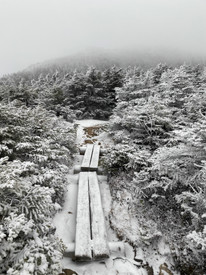
Looking back at the top of Eisenhower... which you cannot see the peak
Back in October I planned to climbed Jackson and Pierce but when I got to the top of Jackson it was winter like conditions, so I decided to skip Pierce and come down via Mitzpah cutoff to Crawford path. To be honest, the conditions scared me, and I did not have the right gear. I thought my hiking days would be put on hold for the winter. Well, I got more gear and continued to hike. Pierce stood out as something I didn’t achieve, even though I was .8 miles away from it, and it bothered me. I felt conquered by the mountains rather than the other way around and I was determined to get the confidence up to summit it once again. So, what better way to turn the tables around? Oh yeah, how about a Mount Washington Observatory Wind Advisory with 45-55 sustained winds with gusts up to 75 mph. Still, I said, well that’s Washington and Eisenhower would see something less than that, right? As a hiker, there is a strange confliction in my mind which is somewhere between determination and sensibility. If I waited for every perfect condition to arise then this journey would not happen. And hey, what about the adventure? What about others who have done similar, so it’s possible, borderline crazy, but a lifetime of a sense of accomplishment.
When I got to Clinton Road parking there was one other car in the lot, and it left before I hit the trail. I had hiked Crawford path several times, so I knew the route as it was a steady consistent 3 mile hike up to Pierce. I told myself that if Pierce were bad conditions that I would simply head back down. Before the short ascent at the tree line, I geared up (something I learned on Jackson) with four layers, face mask, googles, and winter gloves and headed up the short face. The exhilaration of being on a 4000-footer with wind advisory like conditions, however I was warm, and my body felt great… or maybe it was the adrenaline. I knew Eisenhower was 1.6 miles away, another .4 to get back to the tree line and much more exposed, so it would be dicey to say the least. Also, there were no views at all as visibility was maybe 300 feet and there was a 70% chance of snow today which had a chance of closing in on cairn sightings.
The col between the peaks was actually really nice and had chances to briefly stop and drink water and pull out my phone. However, all that stopped when it came to the last push up Eisenhower was in front of me. Although it was at this point that my insulation water bladder froze on me with 5 more miles to go on this hike. Now the fun begins. I was determined. Even though the winds were probably in the 55 mph range they were mostly at my back somewhat helping push my up the ridge. Oh and it started to pelt down so light freezing rain to which doubt started to creep in. This hike was not overly technical to climb but this part had some rock scrambling. There was one part in which required some planning in which could have been disastrous as it needed four points of contact with no room for error as it was on an edge of a cliff. I waited until the gusts briefly slowed down and made my planned calculations of moves to quickly get to the next spot up the trail.


Eisenhower is like a round face with a hug cairn on top and it barrowed wind at me steadily enough to almost knock my large frame over. I got one quick video for posterity as I put my back to the wind thinking my phone would blow all the way down the mountain. There was no time for the common summit activities as I need to get off the top of this mountain and quickly. I followed the cairns to other side of peak to where Edmunds path started and when I came down the first bit was able to catch my breath and smile as now, I could reveal in what just happened. And I only needed to go downwards from here to which the tree lined trail was all that was left.
Top of Eisenhower and its large cairn. It was like another planet

On my way up to Eisenhower
I saw one other hiker going up Edmunds and he was one of those trail runners. He passed me on the way down and yelled “so I was not the only one who read the weather conditions and thought this was a good idea”. To which I noted mentally later that it was his way saying this was a stupid idea. Most of this adventure is stupid in one way or another. I’m ok with that. He also told me he hit probably 75 mph gusts on the top. No wonder he was running. That was probably the quickest I have ever done 2 peaks with 10 miles of hiking. Nothing like the slap of precarious situation to move your feet. Edmunds was a complete ice sheet, and I could have been on the White Mountain National Forest bobsled team. In fact, at one point I slipped down and was sliding maybe a good 20-30 feet with a six-inch tree between me and the edge of the trail. I put my spikes up like Ty Cobb sliding into third base and used that tree to stop myself. I laughed out loud and said to myself… and that, my friend, is hiking. Edmunds dumps out to Clinton road with a solid 2.5 miles of walking back to the car. I put on my earbuds and listened to some tunes while I peacefully strolled to the memories of recent and long-ago times. It’s all an adventure.
Date
December 28th 2020
Distance
10.46
Elevation Gain
3,196 feet
All Trails


Comments